 sagi
sagiLadakh Ancient Trade Routes: Silk Road to Yarkand, Tibet & Baltistan
That distinction matters. On a modern map it is tempting to draw one line from Srinagar to Leh and another from Leh to Yarkand and call it the Silk Road. Historically, Ladakh worked more like a high-altitude exchange system. Caravans changed animals, routes and companions. Some valleys carried long-distance commerce; others acted as feeder routes. A narrow track used by Brokpa traders along the Indus could belong to the same commercial world as the great Leh–Yarkand caravan road without ever carrying the same volume of traffic.
This guide maps that larger system: the famous route through Nubra and the Karakoram, but also the lesser-known corridors through Kargil, Batalik, Hanu, Chorbat and Turtuk that connected Ladakh with Baltistan and the wider trans-Himalayan world.
Ladakh Was Not on One Silk Road
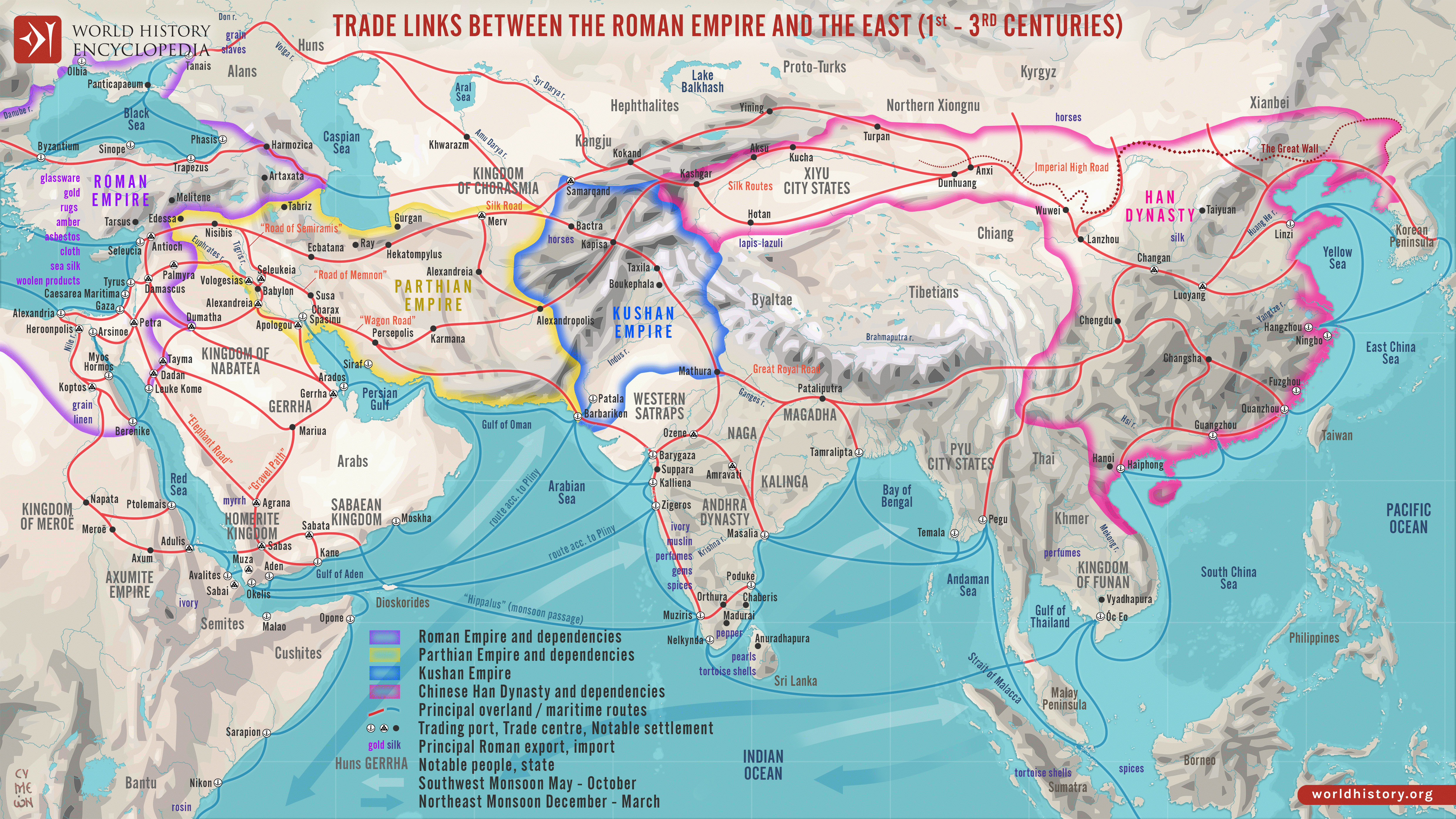
The term “Silk Road” is useful shorthand, but it can also be misleading. There was no single road with a fixed alignment through Ladakh. Trade moved through a web of mountain corridors whose importance changed over time. A pass that was practical in summer might be avoided in winter. A frozen river could become a road. A flood could erase another road entirely. War, taxation, local power and border control could redirect commerce as surely as snow.
Ladakh’s importance came from its position between several economic worlds. To the north lay the markets of Yarkand and Kashgar in what was then Chinese Turkistan. To the east were western Tibet and the caravan routes toward Gartok and Lhasa. To the west were Kashmir and the routes through Kargil and Zoji La. Northwest lay Baltistan, reached through both the Suru–Shingo system and the difficult valleys of Chorbat and Hanu. Southward, tracks through Zanskar, Lahaul and Spiti connected the high plateau with the western Himalaya.
Leh became valuable not because every caravan followed the same road, but because many roads could meet there.
Major Ancient Trade Routes Through Ladakh
| Historical corridor | Approximate line of travel | Main connection |
|---|---|---|
| Leh–Yarkand summer route | Leh → Khardung La → Nubra → upper Shyok / Saser sector → Karakoram Pass → Yarkand | Central Asia |
| Leh–Yarkand winter route | Leh → Digar La → Shyok corridor → Karakoram sector → Yarkand | Central Asia |
| Chang Chenmo alternative | Leh → eastern Ladakh → Chang Chenmo / Aksai Chin corridor → Central Asian routes | Central Asia |
| Kashmir–Leh route | Srinagar → Zoji La → Dras → Kargil → Wakha → Lamayuru → Leh | Kashmir and the Indian plains |
| Kargil–Skardu route | Kargil → Suru/Shingo system → Indus → Baltistan / Skardu | Baltistan |
| Hanu–Chorbat route | Indus near Dah → Hanu Valley → Chorbat La → Chorbat Lungpa → Shyok / Khaplu | Baltistan |
| Batalik–Indus corridor | Lower Ladakh / Aryan Valley → Garkone → Batalik → upper Indus toward Baltistan | Local and regional exchange |
| Turtuk–Chorbat corridor | Nubra → Bogdang → Chalunka → Turtuk → Chorbat / Khaplu | Baltistan and feeder links beyond |
| Western Tibet route | Leh → Changthang → Gartok and western Tibet → routes toward Lhasa | Tibet |
| Southern feeder routes | Ladakh → Zanskar / Lahaul / Spiti / Kullu corridors | Western Himalaya |

The Great Northern Road: Leh to Yarkand
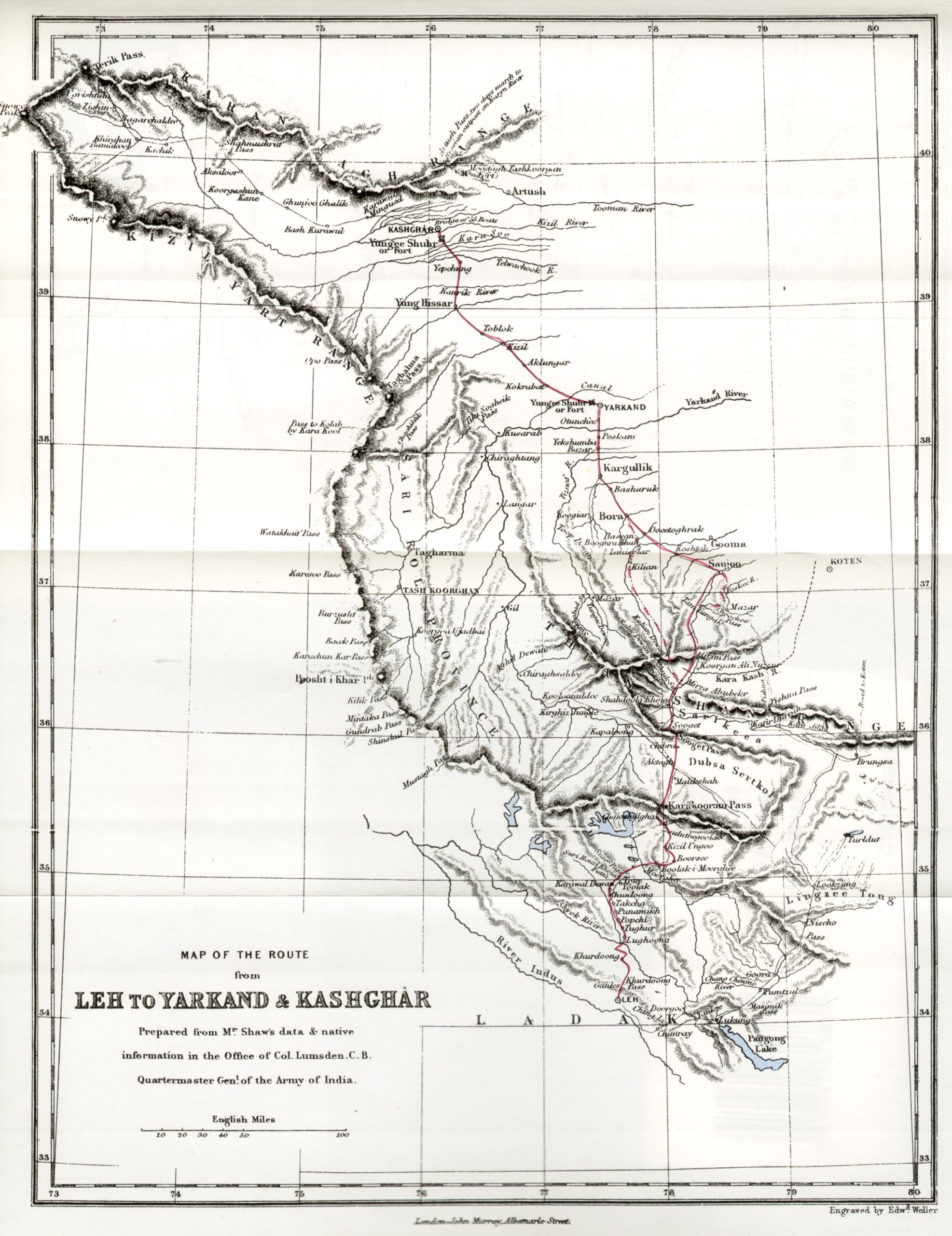
The best-known long-distance caravan connection from Ladakh ran north from Leh toward Yarkand, one of the major commercial centres on the southern edge of the Tarim Basin. Government and historical sources describe the Leh–Yarkand journey through the Karakoram as the preferred route for many merchants from Kashmir and Punjab. The journey took roughly a month under favourable conditions.
But even this famous road was not one road.
The Summer Route Through Khardung La and Nubra
In summer, caravans commonly left Leh over Khardung La and descended into Nubra. From there the route continued through the northern valleys toward the Saser and Karakoram sectors before crossing into the high country leading toward Yarkand. Nubra was therefore not a scenic side valley. It was part of one of Ladakh’s most important historical corridors.
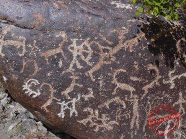
Research published by the International Association for Ladakh Studies records rock engravings between Sasoma, Digar/Tangyar, Diskit and Hundar in an area described as lying on the long-established trade route linking Srinagar, Leh and Yarkand. The same study distinguishes a summer route over Khardung La from a winter route over Digar La, as well as another summer approach to Nubra through Hundar Dok.
The Winter Route Through Digar La and the Shyok
Winter changed the geography. When cold locked parts of the Shyok system in ice, travellers could use the frozen river corridor in ways that were impossible or dangerous during high water. Historical accounts describe winter travellers crossing Digar La and then following the Shyok system toward the Karakoram route.
This is one of the clearest examples of why a fixed “Silk Road map” can be deceptive. In Ladakh, season itself was infrastructure.
The Chang Chenmo Alternative
A further alternative ran eastward through the Chang Chenmo and Aksai Chin region before turning toward Central Asian routes. It was longer than the most direct line through Nubra, but alternative corridors mattered whenever weather, flooding, politics or local conditions made the principal route impractical.
The trader’s map was therefore never only geographic. It was also seasonal and political.
Nubra Was a Caravan Landscape, Not Just a Valley
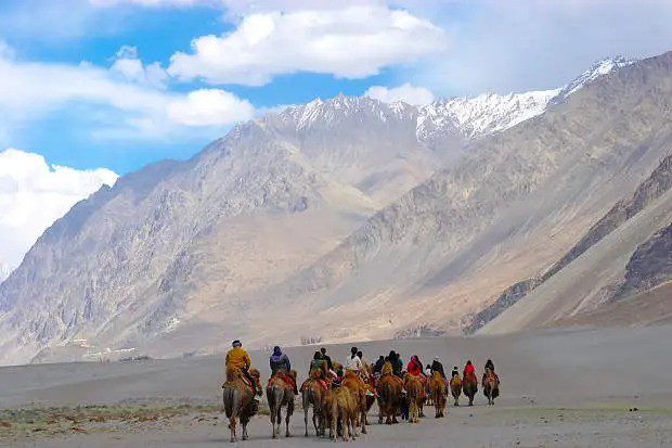
Modern Nubra is often described through sand dunes, monasteries and Bactrian camels. Historically, the valley was also a logistical landscape. Villages, grazing grounds, water, fodder, staging places and local knowledge made long-distance movement possible.
Places such as Diskit, Hundar, Tegar, Sumur and Panamik sat within this larger movement system. Panamik is often associated with caravans preparing for the harder country farther north. Tangyar and the Digar approaches belonged to other lines of movement. The survival of Bactrian camels in Nubra has become a powerful visual reminder of the Central Asian connection, even though the historical network was far more complex than the modern tourist image suggests.
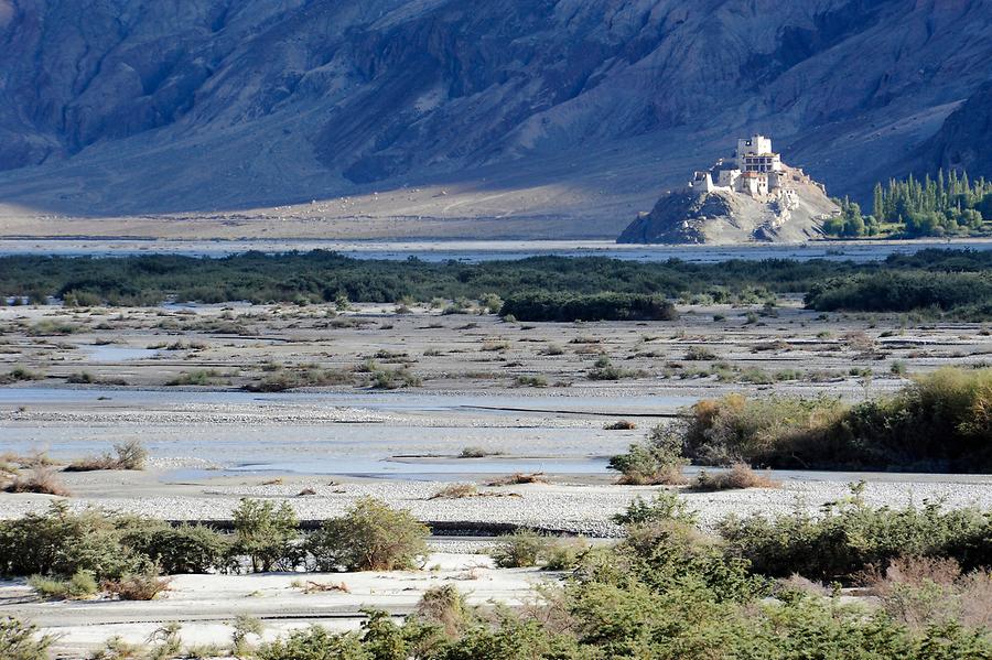
For a more literary view of why these routes were a network rather than a line, see Silk Road Ladakh: The Silk Road Was Never a Road and the Art of Crossing.
The Western Trunk: Srinagar, Kargil and Leh
Most discussions of Ladakh’s Silk Road history jump quickly from Leh to Yarkand. That misses half the system. The northern caravan road mattered because it connected onward to Kashmir and the Indian plains. The western route crossed Zoji La, descended through Dras, reached Kargil, and then continued through the Wakha corridor, Namika La and Fotu La toward Lamayuru and the Indus valley before reaching Leh.
This was one of the great supply lines of the trans-Himalayan economy. Indian cotton goods, dyes, spices, tea and other commodities could move north through this chain; Central Asian wool, felt, carpets, silk and silver could travel south.
Kargil was therefore not merely a stop between Srinagar and Leh. It was a junction.
Kargil: The Western Junction of Ladakh’s Trade Network
Kargil sits where several valleys approach one another. West lies the Dras–Zoji La connection to Kashmir. Southeast, the Wakha Rong leads toward Mulbekh, Namika La, Fotu La and Leh. Northward, the Suru and Shingo river systems open toward the Indus and Baltistan. Other local corridors connected Kargil with the Batalik region and the upper Indus.
Historical descriptions of the Leh–Skardu trade route place Kargil directly on that connection. Caravans moving between Ladakh and Baltistan could follow the Kargil and Suru/Shingo system toward the Indus before continuing toward Skardu.
This is why Kargil deserves its own place on any serious map of Ladakh’s trade history. It linked Kashmir, Leh and Baltistan rather than serving only one road.
LOTPL has a separate story about the commercial memory preserved in Kargil and the Munshi Aziz Bhat family: Silk Road Kargil: A Forgotten Trade Route Rediscovered in Ladakh.
The Batalik and Lower Indus Corridor
Another route followed the Indus through the country now associated with Dah, Garkone, Darchik and Batalik. This corridor needs to be described carefully. The gorge north-westward toward Baltistan could be extremely difficult, and it was not necessarily the preferred road for large caravans. Historical geographical accounts indicate that the easier main trade route between Baltistan and central Ladakh generally used Kargil rather than forcing large commercial traffic through the narrowest Indus gorge.
Yet the difficult river corridor was not empty. Smaller-scale movement and trade did pass through it, and Brokpa communities living along the Indus were part of that regional world. Archaeological investigations along the Indus between Leh and Batalik have also recorded rock engravings, camps and other traces associated with long-term movement by traders, nomads, monks and armies.
That makes Batalik important for a different reason from Leh or Kargil. It was not simply another “Silk Road city.” It belonged to the fine-grained network of tracks that linked local communities with the larger Baltistan–Ladakh exchange system.
Hanu and Chorbat La: A Mountain Door to Baltistan
One of the most fascinating lesser-known routes ran from the Indus near Dah into the Hanu Valley, climbed toward Chorbat La, crossed into Chorbat Lungpa and descended toward the Shyok system and Khaplu.
Nineteenth-century geographer Frederic Drew described the Hanu–Chorbat corridor as an important historical road between Baltistan and Ladakh. The fortified character of settlements in Hanu also reflects the fact that this road carried not only trade and travel but, at times, conflict and raiding.
This corridor matters because it shows how the Indus and Shyok worlds were connected across a high pass. Instead of following the longer Kargil–Wakha line, travellers familiar with the terrain could move between the lower Indus and Chorbat through Hanu.
On a final route map, Hanu–Chorbat La should therefore appear as its own line, not be folded vaguely into “the western Silk Road.”
Turtuk and the Shyok–Chorbat Route
Turtuk belonged historically to the Chorbat cultural and political region along the Shyok. The chain of settlements along this valley linked lower Nubra with the country toward Khaplu and Skardu. In broad terms, a western route could run from Nubra through Bogdang, Chalunka and Turtuk and continue into the Chorbat valleys beyond.
This route should not be confused with the principal Leh–Yarkand road. The famous Central Asian trunk turned north and northeast from Nubra toward the Saser and Karakoram crossings. Turtuk lay to the west, in the Shyok–Chorbat–Baltistan direction.
That difference is exactly what makes Turtuk important. It demonstrates that Nubra was a junction rather than a dead-end valley: one family of routes led toward Yarkand, while another led west into Baltistan. Turtuk can therefore be understood as part of a feeder and regional trade system connected to the larger Silk Road world.
From Baltistan Back Into Ladakh: Two Very Different Roads
Historical accounts describe at least two strikingly different ways of moving from Baltistan into Ladakh.
One was the broader commercial route through the Indus–Suru/Shingo system to Kargil, then over the Wakha corridor toward Leh. The other crossed the much harder Chorbat–Hanu country before reaching the Indus below Khaltse. Both belonged to the same regional economy, but their terrain, scale and users could differ considerably.
This distinction helps explain why a map made only from modern highways misses the historical geography. Some of the most important old connections are no longer through-roads at all.
Eastward: Leh, Changthang and Western Tibet
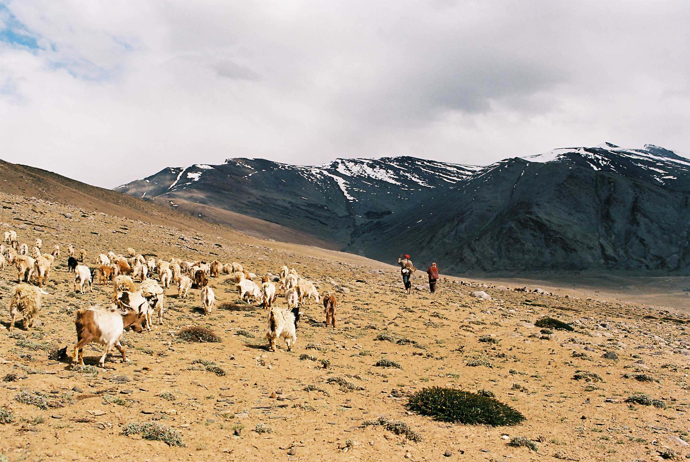
Ladakh’s trade network also opened eastward. Routes crossed the high plateau toward western Tibet, including the commercial centre of Gartok, and connected onward with wider Tibetan networks. Changthang was not an empty wilderness between destinations; it was a pastoral landscape where movement depended on grazing, water, seasonal camps and the knowledge of nomadic communities.
Pashm, salt, wool, tea and other goods moved through the Tibet–Ladakh economy. Trade agreements and political relationships repeatedly shaped access to these routes. The importance of pashm in particular tied Ladakh closely to western Tibet and, through Kashmir’s shawl industry, to markets much farther away.
Southward: Zanskar, Lahaul, Spiti and Kullu
The commercial map also extended south. Historical studies list routes connecting Ladakh through Zanskar and Kishtwar, and other tracks through Lahaul, Baralacha La, Rupshu, Spiti and Kullu. These were not necessarily part of the same long-distance caravan system as the Leh–Yarkand road, but they fed people and goods into Ladakh’s larger exchange network.
This is why the phrase “ancient trade routes of Ladakh” is more useful than treating every track as a branch of one Silk Road. Ladakh participated in several overlapping commercial systems.
Why Leh Became a High-Altitude Entrepôt
Leh’s strength was its ability to make onward travel possible. Caravans arriving from different environments could pause, exchange goods, hire animals, arrange credit, find brokers, receive news about passes and markets, and prepare for the next stage.
Historical observers recorded people and currencies from many regions in Leh’s bazaar. Traders came from Kashmir, Punjab, Central Asia and Tibet, while Ladakhi and Argon intermediaries helped the system function locally. The town was less a remote Himalayan capital than a high-altitude port without a sea.
What moved through Leh was not only cargo. Information moved with equal importance: whether a pass was open, whether a river had flooded, whether a market was paying well, whether a political disturbance had made a road unsafe, whether enough fodder remained for animals farther ahead.
What Goods Moved Through Ladakh?
The name “Silk Road” can make silk seem like the central commodity everywhere. In Ladakh, the trade was much broader.
| Direction or region | Examples of goods |
|---|---|
| India and Kashmir toward Yarkand | Cotton piece-goods, indigo, spices, tea, coral and other manufactured or high-value goods |
| Yarkand and Central Asia toward India | Silver ingots, wool, felt, carpets, silk and other Central Asian goods |
| Western Tibet and Changthang | Pashm, wool, salt and pastoral products |
| Kashmir / Punjab into Ladakh | Grain, cotton, dyes, spices, footwear and manufactured goods |
| Baltistan and western valleys | Dried fruits, regional agricultural products and goods exchanged with wool and salt |
The value of a product depended on where it was scarce. A load worth little in one valley could become valuable after crossing two mountain ranges. Packability mattered. So did durability. Every kilogram had to be carried by an animal or a person across terrain where a delayed journey could consume the profit in fodder and food.
The Animals That Made the Network Possible
Horses, ponies, mules, donkeys, yaks and camels all belonged to different parts of the transport system. No single animal was ideal for every corridor. High passes, desert approaches, river valleys and plateau country placed different demands on caravans.
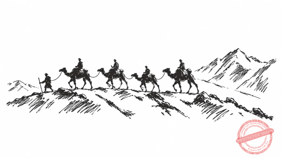
Bactrian camels are the most visible symbol of Ladakh’s Central Asian trade today, especially in Nubra. But the less glamorous animals were equally important. Ponies and mules moved across routes where a camel caravan would be impractical; donkeys carried loads through difficult western tracks; yaks and yak hybrids were suited to high plateau environments.
Trade Was Also a Movement of Language, Food and Ideas
Long-distance trade left marks that cannot be measured only in customs revenue. Central Asian vocabulary entered local speech. Foods, utensils, textiles and tastes travelled. Religious ideas moved beside commercial goods. Art and architecture absorbed influences from Tibet, Kashmir, Central Asia and northern India.
Abdul Ghani Sheikh’s work on Ladakh’s Central Asian relations notes cultural traces ranging from words of Turkic origin to food and artistic influence. Traders did not simply pass through a culturally sealed Ladakh. Repeated movement helped create the Ladakh that later travellers encountered.
The same was true in the west. Balti, Brokpa, Purig and Ladakhi communities were connected by routes that modern political boundaries later cut or constrained. The old roads are therefore not only economic history. They help explain why cultural similarities appear on opposite sides of mountains that now look like hard edges on a political map.
Why the Routes Changed With the Seasons
Modern travel encourages us to think of roads as permanent objects. Caravan travel was different. A river might be dangerous in summer but useful when frozen. Snow could close a high pass while making a lower riverbed easier. Fodder could decide whether a caravan survived a detour. A flood in the Shyok could block movement for weeks.
Historical estimates placed Leh roughly a month from Yarkand by horseback. That did not mean one month on a predictable timetable. The calculation depended on weather, animals, water, local security and the condition of the route.
The true infrastructure of the Silk Road was therefore knowledge: when to leave, which pass to choose, where animals could feed, which village could provide shelter, and which rumours from the next market were worth believing.
How and Why the Old Caravan Trade Ended
These networks did not disappear because mountain people suddenly stopped trading. Political geography changed around them.
Turmoil in Xinjiang, the upheavals surrounding the end of British rule in South Asia, Partition, new borders and the hardening of frontier controls progressively broke the long-distance network. Government historical accounts note that India–Yarkand trade had dwindled dramatically by the late 1940s and then ceased. Routes into Tibet were also transformed by twentieth-century border politics.
The result was extraordinary: valleys that had spent generations as corridors became borderlands. Roads that once joined markets became dead ends. Villages whose geography made sense inside a network suddenly found themselves at its edge.
What Remains of the Silk Road in Ladakh Today?
The old commercial system is gone, but its geography remains visible if you know what to look for.
- Leh’s old bazaar still occupies the town that once organised caravans and exchange.
- Nubra preserves the landscape of the northern approaches, including old tracks, staging villages and Bactrian camels.
- Kargil retains commercial memories connecting Kashmir, Ladakh and Baltistan.
- Hanu and Chorbat La preserve the geography of a route that once linked the Indus and Shyok systems.
- Turtuk and the lower Shyok villages preserve a strong Balti cultural landscape that makes far more sense when seen as part of historic Chorbat.
- Dah, Garkone, Darchik and Batalik sit within an Indus corridor that carried smaller-scale regional movement alongside the major trunk routes.
- Rock engravings, old paths, forts, monasteries, markets and oral histories survive along many of the corridors.
The road is not one monument. It is a pattern scattered across the landscape.
Can You Follow Ladakh’s Old Silk Road Today?
Only in fragments. Some historical corridors now coincide broadly with modern roads, such as parts of the Srinagar–Kargil–Leh route or the approach from Leh into Nubra. Other sections lie in restricted border country, cross present-day international boundaries, or no longer function as through-routes at all.
The Karakoram Pass and many of the historical approaches beyond northern Nubra are not normal trekking routes. Chorbat La is in sensitive frontier terrain. Historical lines toward Baltistan and Yarkand cross borders that are closed to this kind of travel.
The meaningful way to experience the Silk Road in Ladakh today is therefore not to claim that a modern itinerary “follows the whole Silk Road.” It is to understand the surviving pieces: the valleys, villages, markets, monasteries, old caravan landscapes and stories that once formed a connected system.
For the human and cultural side of the caravan world, see Silken Paths and Snowy Peaks – Ladakh Caravan Routes and Cultural Heritage.
Frequently Asked Questions
Was Ladakh part of the Silk Road?
Yes, but not as a single fixed road. Ladakh formed part of a wider trans-Himalayan network connecting Kashmir and northern India with Central Asia, Baltistan and Tibet. Leh became an important exchange centre within that network.
What was the main Silk Route from Leh to Central Asia?
The best-known route ran from Leh through Nubra and the Karakoram system toward Yarkand. Summer traffic commonly used the Khardung La approach into Nubra, while historical sources also record winter travel via Digar La and the Shyok corridor. Alternative approaches existed through the eastern highlands.
How long did it take to travel from Leh to Yarkand?
Historical sources commonly describe the journey as taking about a month by horseback under workable conditions, though weather, flooding, snow, animals and political conditions could change travel times considerably.
Did the Silk Road pass through Turtuk?
Turtuk belonged to the historic Chorbat region along the Shyok and was connected to regional trade toward Khaplu and Baltistan. It is better understood as part of a western feeder and regional trade system than as the principal Leh–Yarkand trunk, which turned north from Nubra toward the Karakoram.
Was Batalik on an ancient trade route?
The Indus corridor through the Batalik region carried regional movement and trade, although the narrow gorge toward Baltistan was difficult and the larger commercial route between Leh and Skardu generally used Kargil. Archaeological work along the Leh–Batalik Indus corridor has recorded evidence of long-term movement through this landscape.
What was the role of Kargil in the trade network?
Kargil was a major western junction. Routes connected it with Kashmir through Dras and Zoji La, with Leh through Wakha, Namika La and Fotu La, and with Baltistan through the Suru/Shingo and Indus systems.
What was the Hanu–Chorbat route?
It was a historical route linking the Indus valley near Dah with Baltistan. It climbed the Hanu Valley to Chorbat La, crossed into Chorbat Lungpa and descended toward the Shyok and Khaplu region.
What goods were traded through Ladakh?
Goods included pashm and wool, salt, tea, cotton textiles, silk, felt, carpets, spices, indigo, coral, silver, grain, dried fruit and many other regional products. What moved varied by route, market and period.
Sources and Further Reading
- International Association for Ladakh Studies: Janet Rizvi, Leh to Yarkand: travelling the trans-Karakorum trade route.
- International Association for Ladakh Studies: Abdul Ghani Sheikh, Ladakh’s Relations with Central Asia.
- International Association for Ladakh Studies: Tashi Ldawa Tshangpa, A Short Note on Some Petroglyphs of the Nubra Valley.
- Frederic Drew, The Jummoo and Kashmir Territories: A Geographical Account (1875).
- Janet Rizvi, Ladakh: Crossroads of High Asia.
- Government of India, Ministry of External Affairs, Encyclopedia of India-China Cultural Contacts, entry on Yarkand.
- Archaeological Survey of India, Indian Archaeology 1998–99: A Review, investigations along the Indus, Kargil–Padum and Leh–Batalik corridors.
Editorial note: Historical trade routes in Ladakh changed by period and season. The alignments above are presented as historical corridors rather than as modern navigable routes. Several now cross sensitive or closed borders and should not be interpreted as present-day trekking instructions.

 sagi
sagi
 Writer