 sagi
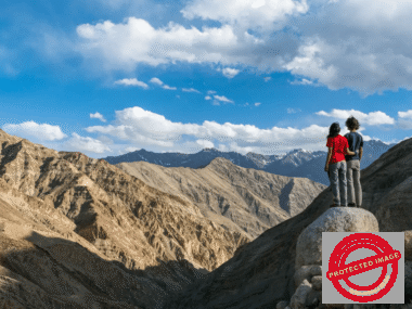
sagiThe Rumtse to Tso Moriri trek is one of Ladakh’s great high-altitude crossings: a long traverse from the Indus-side village of Rumtse into the open Changthang plateau, past the Tso Kar basin and across a succession of 5,000-metre-class passes before the first blue view of Tso Moriri appears from above Korzok. It is remote, exposed and physically demanding. That is precisely why the route feels so different from shorter treks near Leh.
This is not a trek we describe as beginner-friendly. Most nights are spent above 4,000 metres, there are repeated high passes, long stretches without permanent settlements, river crossings and very limited options for a quick exit. A strong support team, conservative acclimatization and flexibility for weather and trail conditions matter more here than shaving a few hours from the itinerary.
Rumtse to Tso Moriri at a glance
| Typical LOTPL format | 10 days including acclimatization and the return drive |
|---|---|
| Trekking days | About 8 days, depending on the chosen camp plan |
| Terrain | High desert, broad valleys, alpine pasture, wetlands, scree, stream and river crossings |
| Highest section | Yarlung Nyau La, above 5,400 m on commonly used route descriptions |
| Difficulty | Challenging; best for trekkers with good fitness and prior multi-day trekking experience |
| Best general season | July to September, with conditions checked locally before departure |
| Finish | Korzok, on the shore of Tso Moriri |
Why this trek is special
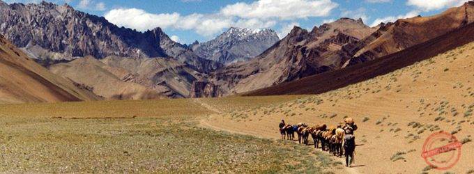
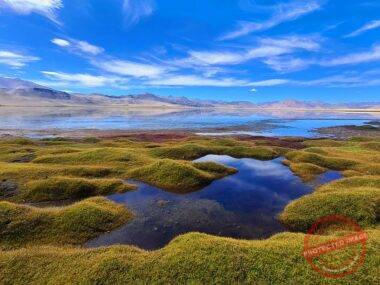
The route is less about one summit or one famous viewpoint than about the gradual change of landscape. From Rumtse, the trail enters broad valleys where streams feed summer grazing grounds. Higher up, the green strips become smaller and the mountains open into dry, mineral-coloured terrain. After Shibuk La the Tso Kar basin appears, and the character of the trek changes again: salt-edged wetlands, open sky and the enormous scale of Changthang.
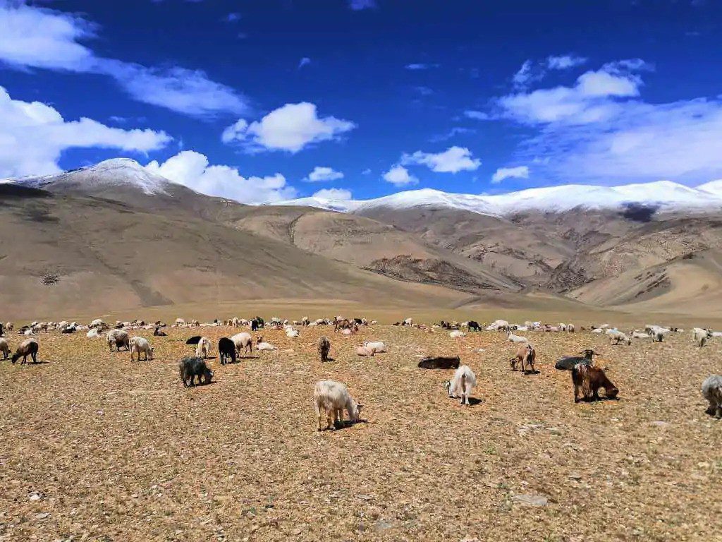
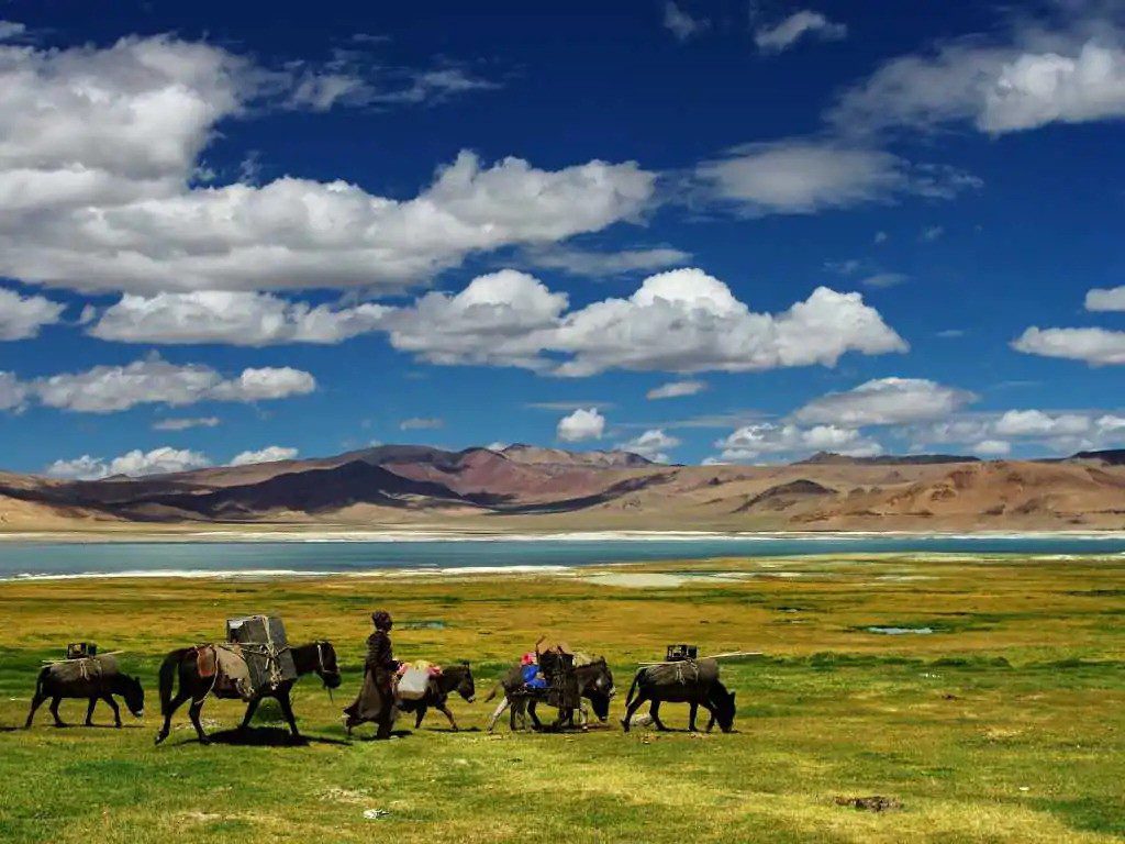
Farther south, the trail passes summer grazing areas used by Changpa pastoral communities. Encounters vary from season to season and should never be treated as a staged attraction. The best approach is simple: give people and livestock space, ask before photographing anyone, and let the guide handle local introductions.
The wildlife is another reason to move quietly. Tso Kar Wetland Complex is a Ramsar wetland above 4,500 metres and an important breeding and stopover area for high-altitude birds, including the black-necked crane. The wider Changthang landscape also supports kiang and other cold-desert wildlife. Sightings are never guaranteed, but slow travel on foot gives this route a very different relationship with the plateau than a fast road journey.
10-day Rumtse to Tso Moriri itinerary
Distances and camp locations can change with water levels, grazing activity, weather and the condition of river crossings. The outline below reflects the classic direction from Rumtse to Korzok and keeps a deliberate rest day before the final high-pass section.
Day 1: Acclimatization in Leh
Use the first day for rest and altitude adaptation in Leh rather than treating it as a sightseeing marathon. Leh is already around 3,500 metres. Hydrate normally, eat well, sleep, and keep exertion light. For this trek, arriving in Ladakh and immediately driving to sleep near 4,000 metres is not a sensible shortcut.
Day 2: Leh – Rumtse – Kyamar
Drive from Leh to Rumtse and begin walking into the Kyamar valley. The first trekking stage is roughly 9 km and commonly takes four to five hours. The walking itself is not technically difficult, but the campsite is already high, so pace matters. The valley alternates between dry trail, streamside ground and patches of summer grazing land.
Day 3: Kyamar – Kyamar La – Mandachalan La – Tisaling
This is the first serious test. The route crosses two high passes and is often described as a 15 km day taking eight to nine hours. Loose ground and the cumulative altitude make the day harder than the distance suggests. Tisaling is a beautiful high camp, but reaching it with energy left is more important than reaching it quickly.
Day 4: Tisaling – Shibuk La – Pongunagu, Tso Kar
Climb toward Shibuk La and then descend toward the Tso Kar basin. The first broad view of the lake and surrounding wetlands is one of the major transitions of the trek. A typical stage is around 15 km and six to seven hours. The descent can be rough underfoot, and the openness of the basin means sun and wind can be strong even when the air feels cool.
Day 5: Pongunagu – Nuruchen
Follow the Tso Kar side of the route toward Nuruchen, generally around 16 km. Compared with the pass days, the profile can feel gentler, but the altitude remains high. This is a day to watch the landscape rather than chase wildlife: birds, kiang or other animals may be present, but approaching or disturbing them is not part of the trek.
Day 6: Nuruchen – Horlam La – Rachungkharu
A shorter stage crosses Horlam La and reaches the Rachungkharu area. The reduced walking time is useful because the body is now spending consecutive nights at very high altitude. In summer, this part of Changthang may be used by pastoral families and their herds. Camps should be placed with local use of pasture and water in mind.
Day 7: Rest and acclimatization at Rachungkharu
The rest day is not wasted time. It provides a buffer before the hardest final section and gives the team room to respond if someone is not adapting well. Short walks around camp are fine for people who feel strong, but the purpose is recovery. Headache, nausea, unusual fatigue, poor coordination or worsening breathlessness should be treated seriously rather than hidden to protect the itinerary.
Day 8: Rachungkharu – Kyamayaru La – Gyamar La – Gyamalhoma
Another long high day, with two major pass crossings and several streams or river channels depending on seasonal flow. A commonly used outline is about 13 km and around six hours, but crossing conditions can extend the day. This is exactly the kind of stage where an experienced local guide and horse team are more important than a rigid timetable.
Day 9: Gyamalhoma – Yarlung Nyau La – Korzok
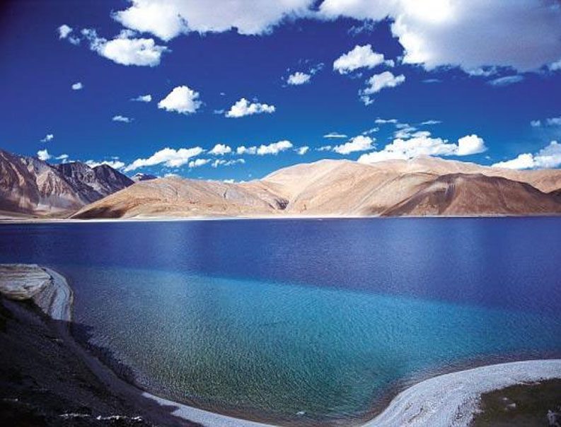
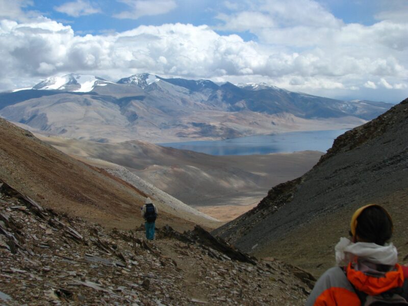
The final trekking day climbs to Yarlung Nyau La, the highest point on the usual route, before descending toward Korzok. The first view of Tso Moriri from the pass is the natural climax of the traverse. The day is commonly described as 12–14 km and six to seven hours. Even though the finish is below the pass, Korzok itself remains at very high altitude, so the descent is not a return to low elevation.
Day 10: Korzok – Leh by road
Return to Leh by vehicle. Road time varies with the route, traffic and conditions, so we do not treat a fixed driving time as a guarantee. After more than a week on foot, this is also the day when the scale of the traverse becomes obvious: the return by road crosses in hours what the trekking route has taken days to unfold.
Acclimatization is the main safety issue
The defining difficulty of Rumtse–Tso Moriri is not technical climbing. It is sustained altitude. Rumtse is already around 4,000 metres, and the route spends day after day well above that level. Several passes rise above 5,000 metres. A trekker can be very fit at sea level and still acclimatize poorly.
We prefer a conservative approach: arrive in Leh with enough time to adapt, avoid a hard first day, keep walking pace steady, and make decisions based on symptoms rather than ambition. Medication is not a substitute for acclimatization or descent when altitude illness is suspected. Anyone with relevant medical concerns should discuss high-altitude travel with a qualified clinician before the trip.
How difficult is Rumtse to Tso Moriri?
For planning purposes, we class it as challenging. Previous trekking experience is strongly recommended. You should be comfortable walking six to eight hours on consecutive days while carrying a daypack, climbing and descending on loose terrain, and living in a tent for multiple nights.
Training should focus on sustained aerobic work and leg endurance rather than short bursts of speed. Long hill walks, stairs, hiking with a loaded daypack and back-to-back training days are more useful than relying only on gym strength. The aim is to arrive with enough reserve that altitude, cold and a difficult river crossing do not consume your entire margin.
Weather and the best time to trek
July to September is the main trekking window for this route. That does not mean every day is mild or stable. At 4,500–5,000 metres, nights can be cold, strong sun and wind can occur on the same day, and fresh snow is possible on high passes. Stream levels also change with temperature and recent weather.
Instead of choosing a departure only from a generic monthly chart, check the route close to departure with a local team. Snow on a pass, unusually high water or a change in road access can matter more than the historical average for that month.
What to pack
| Category | What matters on this route |
|---|---|
| Footwear | Broken-in trekking boots with reliable grip and ankle support |
| Warmth | Layering system with thermal base layers, fleece or insulated mid-layer and a warm down jacket |
| Weather protection | Waterproof shell, sun hat, warm hat and gloves |
| Sleep system | Warm sleeping bag suitable for freezing high-altitude nights, plus an insulated mat |
| Sun protection | High-SPF sunscreen, lip protection and UV-protective sunglasses |
| Water | Reusable bottles or hydration system; purification method as advised by the trek team |
| Personal medical kit | Regular medication and any altitude-specific plan discussed with your clinician |
Tso Kar, Tso Moriri and responsible travel
The ecological context of this trek is not decorative. The route enters a fragile cold-desert landscape. The Ramsar Sites Information Service lists both the Tso Kar Wetland Complex and Tsomoriri as Wetlands of International Importance, while the UT Ladakh Forest, Ecology & Environment Department identifies Changthang as a protected high-altitude wildlife sanctuary.
That means simple behaviour matters: stay on established routes, do not drive or ride off-road near wetlands, keep distance from nesting birds and wildlife, carry waste out, and avoid turning pastoral camps into photo sets. In July 2026, the Ladakh Administration publicly reported penalties for illegal off-roading near Tso Moriri, a useful reminder that fragile ground here is protected for a reason.
Guide, camp team and evacuation reality
This is not a teahouse trek. Camps, food, fuel, tents and load transport need to move with the group. Mobile coverage cannot be relied upon across the route, and evacuation is constrained by terrain and road access. The Tso Kar side offers one of the more practical road-access points on the traverse, but much of the route is genuinely remote.
A local team should therefore do more than lead the trail. It should manage camp locations, water, pack animals, weather decisions, river crossings, pace and contingency planning. Before departure, trekkers should know what communication equipment the team carries, what the evacuation plan is, what insurance is required and what happens if a member needs to descend or leave the route.
Frequently asked questions
Can a first-time trekker do Rumtse to Tso Moriri?
We do not recommend it as a first multi-day high-altitude trek. A fit beginner with excellent preparation may be capable of the walking, but altitude and remoteness add risks that fitness alone does not solve. Prior trekking experience gives you a much better reference point for pacing, equipment and recovery.
Is the route technical?
No mountaineering or rope-based climbing is normally required on the standard route, but “non-technical” does not mean easy. Loose slopes, long pass days, cold, river crossings and sustained altitude make it a serious trekking route.
Will we definitely see black-necked cranes or kiang?
No. The Tso Kar and Changthang landscapes are important wildlife habitats, but wild animals are not scheduled attractions. Sightings depend on season, location, weather and luck, and observation should always be from a respectful distance.
Why trek from Rumtse toward Tso Moriri rather than the opposite direction?
The classic direction creates a powerful geographical progression from Rumtse into Changthang and finishes with the reveal of Tso Moriri from Yarlung Nyau La. It also fits naturally with a vehicle pickup from Korzok. The exact plan should still be adapted to acclimatization, local conditions and the group.
Planning the trek
For us, Rumtse–Tso Moriri is a route to plan carefully rather than sell as a checklist adventure. We can arrange the local guide, cook, camp equipment, pack animals, food, transport and route logistics, and we build the walking plan around the group’s experience and acclimatization rather than forcing every departure into the same timetable.
If you are considering this traverse, tell us your previous trekking experience, approximate travel dates, group size and how many acclimatization days you have in Ladakh. We can then advise whether the full Rumtse–Tso Moriri route is the right choice or whether another Ladakh trek would give you a better trip.
Compare routes, seasons and difficulty in our Ladakh trekking guide.

 sagi
sagi
 Writer